Fraser Coast

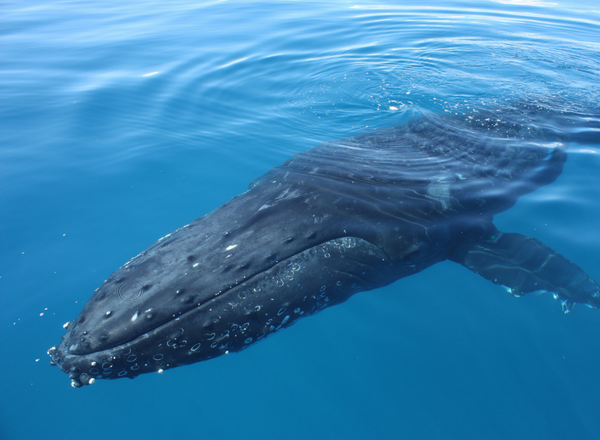
The Fraser Coast region lies approximately 250 kilometres north of Brisbane. It is famous for iconic beaches and humpback whales, but the unique subtropical coral communities of this region are often overlooked.  

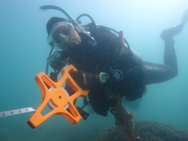
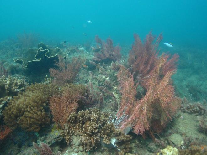
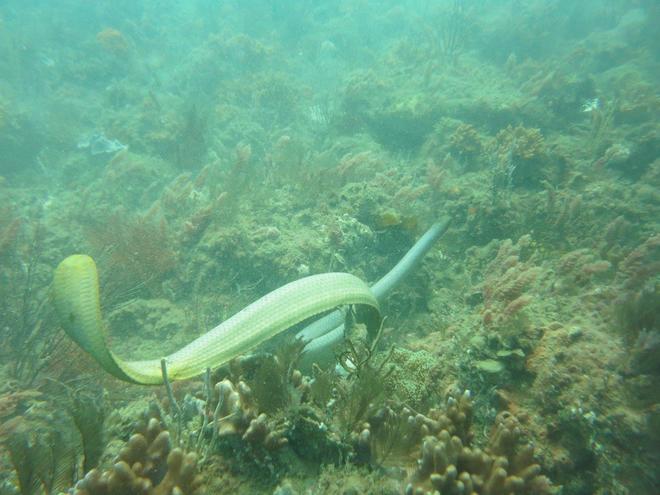
The Fraser Coast region hosts patchy, but notable fringing nearshore reef areas. These reefs are home to a mix of subtropical and temperate marine species, including nudibranchs, corals, sea snakes and sea turtles. Research indicates that these reefs are actually more similar to the Great Barrier Reef to their north, than to Moreton Bay reefs to their south.

These fringing reefs and the diverse marine wildlife in the region have been identified as high conservation value by the regional Natural Resource Management body, Burnett Mary Regional Group (BMRG).  

Regional Updates

Great Sandy 2017 report released

May 15, 2018
The results from the 2017 Great Sandy Survey Report are in!  The Great Sandy Marine Park hosts unique subtropical coral communities. In Queensland, inshore fringing reefs off the mainland coast is relatively unique. In June 2017, teams checked up on 5 long-term monitoring sites established in 2012 (Barolin Rocks, Burkitt’s Reef, Big Woody Island, ESA Park, Gatakers Reef West) and added an additional site at Round Island.  As per previous surveys, both monitoring sites in the Woongarra Coast region were dominated by soft coral, where as Hervey Bay sites had higher levels of hard coral. Coral bleaching was reported across all sites (average 18%) of the population.  https://youtu.be/ZWh6bPw75Xs
Read more

Data set 81: Checking maps for Great Sandy reefs

September 17, 2017
Checking up on reef habitat in the Great Sandy Strait In September 2016, 17 community volunteers joined in workshops and field activities to increase current knowledge about reef habitats across the Great Sandy Strait.  Extensive habitat maps have been developed for the Great Sandy/Wide Bay Burnett state waters through the draft Queensland Intertidal and Subtidal Benthic Classification scheme. The first habitat map for the intertidal and marine habitats uses 29 benthic habitat types, based on 80 existing datasets from a range of research and management projects across the region.  However, the combined datasets, high resolution satellite imagery and expert mapping advice identified a number of potential reefal areas that required ground truthing for validation. This project was designed to engage citizen scientists in ground-truthing activities along the length of the Great Sandy Strait to help refine data for available reef habitat maps. Volunteers contributed dataset 81, providing first hand field data on the habitat composition for these locations.   Two interactive workshops prepared participants with a crash course in reef ecology, benthic identification skills and data collection procedures. Many volunteers then joined us in the field to put their new skills into practice! Dataset 81 Expedition  From Urangan to Tin Can Bay, volunteers visited areas key reefal areas to conduct hundreds of spot checks via a combination of drop cameras, viewing buckets and snorkel surveys. We were lucky enough to undertake this expedition onboard the Science Under Sail vessel, MV Velella, a 12m sailing catamaran with a small support vessel (a 3.6m RIB). The weather was on our side, for 5 days of Great Sandy Marine Park at its finest!  Our team explored a range of reef habitats, sometimes confirming areas of coral or sponge habitat, sometimes finding, well, lots of sand. Its all important and the crew enjoyed the process of discovery, knowing it was providing an important contribution to maps that can support best-practice science and management for this beautiful and unique part of the world.  In addition to data collection, participants also helped with data management onboard the boat and learned about the unique marine habitats of Great Sandy Marine Park. There was plenty of plotting too, with talk of more spot checks, plans by local Seagrass Watch volunteers to cross-reference their new reef knowledge and integration of mapping data collection into more detailed marine surveys of Norman Point and Seary's Ledge. Next steps The spot check data will now be reviewed and assessed by UQ's Remote Sensing Research Centre, who will create a digital spatial data file outlining the extent of the reef inventory areas, which can be shared and discussed with project partners. We are also working on creating a matrix of category references to directly link RCA habitat mapping data with the Queensland Intertidal and Subtidal Benthic Classification scheme, directly integrating datasets and providing a framework for other projects to utilise.  Project support This project is supported through the Burnett Mary Regional Group Keeping It Great grants with funding from the National Landcare Program. Thank you to project partners including The University of Queensland Remote Sensing Research Centre, Science Under Sail and Cooloola Coastcare. A special thank you to Maria Zann, Chris Roelfsema, James Udy and Maree Prior for their sage guidance and general awesomeness. 
Read more

New reef monitoring program for Fraser Coast

August 29, 2012
Our teams braved the chilly winter waters off the Fraser Coast to establish the first long-term monitoring locations in the area, helping to close the gap between our Great Barrier Reef sites and South East Queensland sites. The team visited 5 sites, including 3 sites inshore Hervey Bay and two off the Woongara Coast near Bundaberg. We worked with local management authorities and researchers to select sites with existing baseline data and important management priorities, with water quality as a particular focus. Reef Check sites will help to provide additional long-term reef health data for these unique subtropical reef systems. Thanks very much to Great Sandy Marine Park, Bundaberg Aqua Scuba, Bundy Dive Charters, the Hervey Bay Boat Club and a few passionate locals for all of your help implementing this new project. This project is supported by funding from the Australian Government’s Caring for Our Country.
Read more